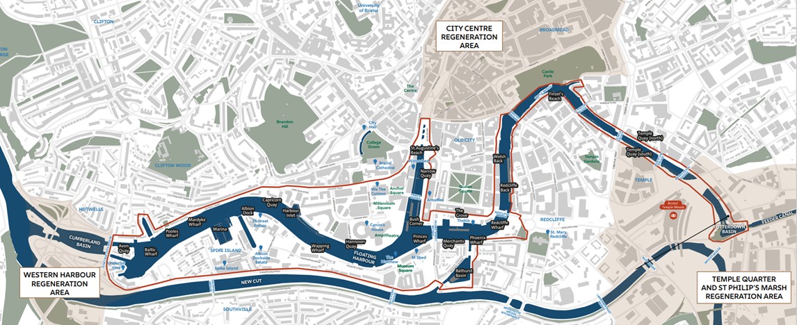
The Harbour Place Shaping Strategy project area is Bristol's Floating Harbour, its water space, the quayside and the activities that contribute to it being a much-loved place.
Bristol's Floating Harbour extends from Junction Lock Bridge (near Underfall Yard) to Totterdown Basin (behind Temple Meads Station).
It links the city's three main regeneration areas:
The area does not include the New Cut (River Avon), Feeder Canal or Cumberland Basin.